Grib and QGIS
Thanks to the MDAL library, integrated in QGIS since the 3.2 release, it is possible to use this new data type. An extensive guide of this data is in the official QGIS documentation.
Find and download these data is not so easy: there are many online resources, (ECMWF, NASA) but none of them is really user friendly.
The OpenGribs Open Source software allows with a simple UI to select an area and download the data: Basically this software is sending requests to the servers that return the data.
We were looking for a simpler solution directly integrated in QGIS.
During the QGIS HackFest of Padova in February 2019, thanks to Enrico Ferreguti, we developed the QGribDownloader plugin.
Here a very short guide:
-
Search and download the
QGribDownloaderplugin: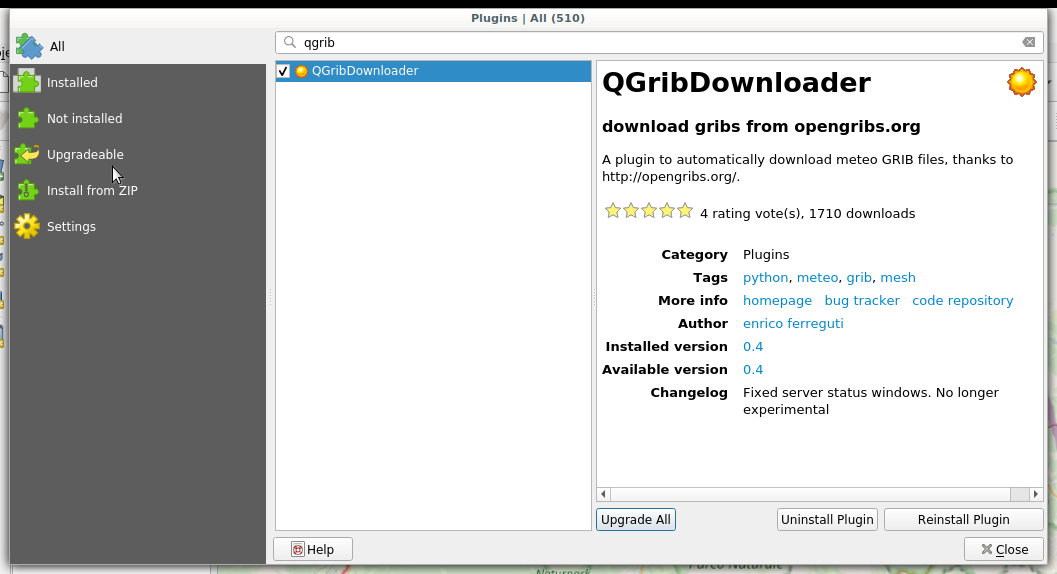
-
Zoom to an area and click on the plugin icon
 to open the
settings panel:
to open the
settings panel: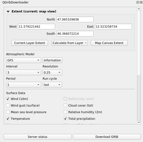
-
You can now select many different options: meteorological model, variables to to download, etc. Click on
Download Griband select the folder where to save the data: once downloaded the data are automatically loaded in QGIS -
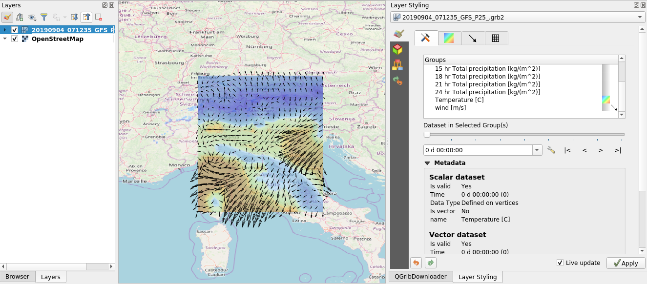
Use all the standard symbology option of QGIS to create the meteo map:
We can make many enhancements to the plugin, just write us.
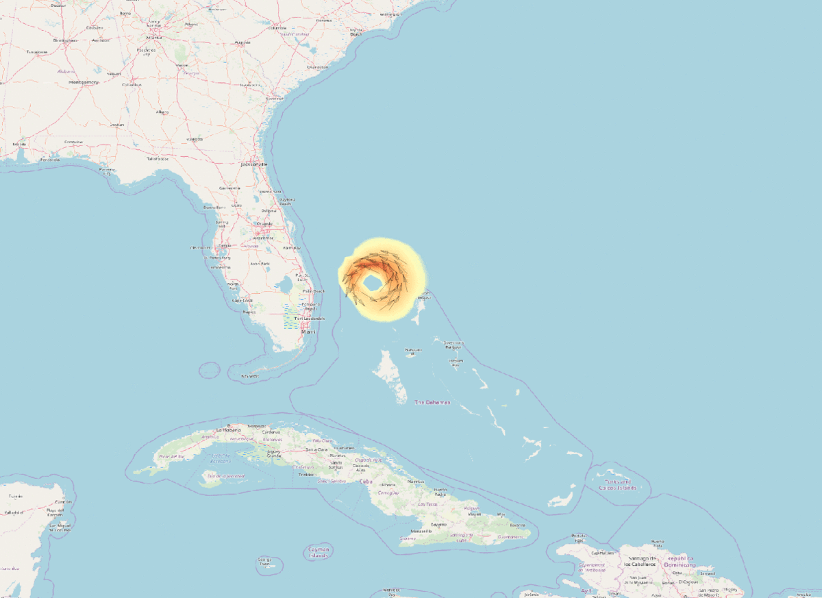
Another example from our blog: the evolution of the Dorian hurricane. Cool isn't it?!