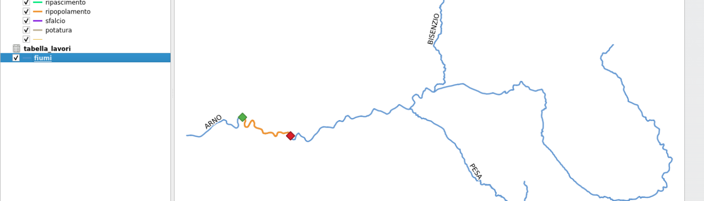
Basic concepts
LRS (Linear Reference System) is a spatial reference method where the places along a path have distance measures compared to some specific points, like milestones of a road.
Imagine the following scenario:
- linear river layer
- non-spatial table with the description of the oper...
Extension of the DataPlotly crowdfunding campaign
Together with North Road we are running a crowd funding campaign to extend the layout print capabilities of QGIS.
While the funds were not raised within the original deadline of 30th April, we decided to extend the deadline for other 30 days...
Continue ReadingQGIS Sweden User Group
Paolo Cavallini, as QGIS.ORG Chair, has been invited to the annual meeting of the local group of QGIS Sweden.
Many interesting topics will be discussed, click on the link fir the detailed program.
Continue Reading
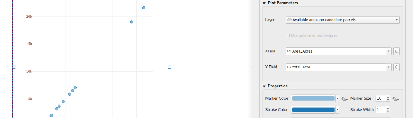
DataPlotly crowdfunding campaign
Link of the Crowdfunding campaign
The QGIS DataPlotly plugin (developed by Faunalia) allows for creation of D3-like interactive plots directly within QGIS, using the feature-rich and mature Plotly library. Although it’s been designed with simplicity in mind, th...
Continue ReadingECW Support in QGIS
The following instructions are deprecated for QGIS 3.
The support is enabled by default on Windows, and probably no longer necessary on other Operating Systems.
For all your needs on GIS data management, do not hesitate contacting us.
Proprietary (closed) fo...
Continue Reading